FAA cycle effective Jul 9, 2026
Current Weather
Nearby Attractions
In this below-sea-level basin, steady drought and record summer heat make Death Valley a land of extremes. Yet, each extreme has a striking contrast with towering peaks frosted with winter snow and rare rainstorms bringing vast fields of wildflowers.
Furnace Creek Campground is located in Death Valley National Park, offering a unique desert camping experience with access to stunning landscapes and natural wonders.
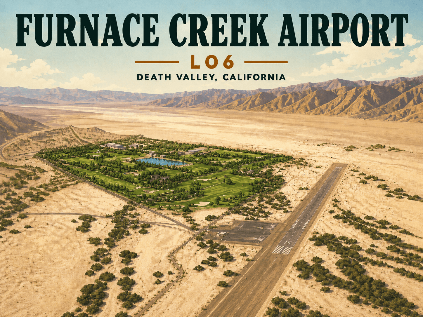
The Furnace Creek Golf Course at Death Valley offers a unique golf experience as the world's lowest elevation golf course, set at 214 feet below sea level in the heart of Death Valley National Park.
Pilot Videos · 5
Approach, pattern, and field-familiarization videos shared by pilots and reviewed by MapTurtle curators.
24 Hours in the Hottest Town on Earth
Video by Michael Berriman on YouTube
Runway Information
Runway 15/33
PrimaryDimensions
3065 x 70 ft
Surface
ASPH
Treatment
NONE
Communications
CTAF
122.9
ARTCC
ZLA
Flight Service Station
1-800-WX-BRIEF
Charts & Documents
Airport Diagram
FAA airport/taxi diagram
Chart Supplement
Additional airport information
Airport Notes
ESTABD PRIOR TO 5/15/59. ARPT LCTD 1 SM SW OF PARK HEADQUARTERS. USE ONLY MKD RY FOR GROUND OPNS. SAFETY AREA ROUGH & SOFT. NO TIEDOWN ROPES OR CHAINS AVBL. DITCH 145 FT RIGHT OF RY 33. SAFETY AREAS ADJ RY CLSD, STAY ON PAVED AREA ONLY DUE TO EXTREMELY SOFT DIRT. ARPT CLSD TO NIGHT OPS. FOR CD IF UNA TO CTC ON FSS FREQ, CTC LOS ANGELES ARTCC AT 661-575-2079. RWY 15/33 PAVEMENT HEAVING, EXTREMELY ROUGH SFC. POTENTIAL FOR DMG TO ACFT USING THIS RWY. NOT RCMDD FOR ACFT WITH WHEEL PANTS. CA STATE PMT HAS BEEN SUSPD UNTIL FURTHER NOTICE. AIRPORT MANAGER IS A LAW ENFORCEMENT PARK RANGER, FOR EMERGENCIES CAN BE REACHED THROUGH PARK DISPATCH 760-786-2330 UP TO 4 INCH SALT HEAVE ARND RWY CRACKS. COULD DMG ACFT WITH WHEEL FAIRINGS OR CAUSE A POTENTIAL TO BLOW OUT A TIRE.
Operations
Segmented Circle
Yes
Location & Coordinates
Latitude
36.4605
36.4605000°
Longitude
-116.87980555
-116.8798056°
Elevation
-210 ft MSL
Magnetic Variation
14
Sectional Chart
LAS VEGAS
Contact Information
Airport Manager
PHILIP JOHNSON
760-786-3245
DEATH VALLEY NATL PARK, DEATH VALLEY, CA 92328
Owner
US DEPT OF INTERIOR/PARK SVC
760-786-3245
DEATH VALLEY NATL PARK, DEATH VALLEY, CA 92328
Reviews
No reviews yet
Be the first to review FURNACE CREEK (L06).
Have you been to FURNACE CREEK (L06)?
Sign in to share your rating and review.
Sign in to write a review